
Religion
See other Religion Articles
Title: Major storm to slam the U.S. - God controls the weather and boy oh boy is the United States right in the path
Source:
weather.com
URL Source: http://www.weather.com/newscenter/stormwatch/?from=wxcenter_news
Published: Nov 29, 2006
Author: weather.com
Post Date: 2006-11-29 21:31:26 by TLBSHOW
Keywords: None
Views: 4235
Comments: 7
Major storm to slam the U.S. A potpourri of winter storm watches, warnings, and ice storm warnings are currently posted from north Texas to Illinois in advance of a powerful winter storm expected to get organized overnight and track northeastward into the mid-Mississippi Valley and Great Lakes by late Thursday and Friday. Overnight, snow will leave the southern Rockies and spread into the Texas Panhandle, western and central Oklahoma, and north Texas, including parts of the Dallas-Ft. Worth metro area. As the bullish upper-level storm swings through Thursday, snow could become heavy in eastern Oklahoma and northwest Arkansas, lifting into southeast Kansas and western Missouri. A thin band of sleet, freezing rain, and snow should persist tonight through early Thursday from the hills of southwest Missouri into northern Illinois. However, the main event will be overnight Thursday and Friday morning. A swath of heavy snow will overspread much of northern and central Missouri, possibly including the St. Louis metro. Any mix of freezing rain or sleet in Chicagoland could turn quickly to heavy snow Thursday night into Friday morning. During the day Friday, this snowy swath should spread into Lower Michigan, and may stretch as far south as northern Indiana and northwest Ohio. If that wasn't enough, severe thunderstorms are expected through the late evening hours Wednesday from southwest Missouri to Texas. Large hail, damaging winds, and a few tornadoes are possible. Astonishingly, some of these same areas will be dealing with snow or ice on Thursday! The severe threat then shifts Thursday into the Lower Mississippi Valley and central Gulf Coast. Damaging winds and hail will be the main threats Thursday. If enough instability is able to build, tornadoes are possible.
Poster Comment: California Watches and Warnings National Weather Service Zone - CAZ042 SGXNPWSGX WWUS76 KSGX 300022 NPWSGX URGENT - WEATHER MESSAGE NATIONAL WEATHER SERVICE SAN DIEGO CA 422 PM PST WED NOV 29 2006 CAZ048-300915- /O.CON.KSGX.HW.W.0007.000000T0000Z-061201T0200Z/ /O.CON.KSGX.FR.Y.0005.061130T0900Z-061130T1600Z/ /O.CON.KSGX.FZ.A.0001.061201T0900Z-061201T1600Z/ SAN BERNARDINO AND RIVERSIDE COUNTY VALLEYS-THE INLAND EMPIRE- 422 PM PST WED NOV 29 2006 HIGH WIND WARNING REMAINS IN EFFECT UNTIL 6 PM PST THURSDAY... FROST ADVISORY REMAINS IN EFFECT FROM 1 AM TO 8 AM PST THURSDAY. FREEZE WATCH REMAINS IN EFFECT FROM LATE THURSDAY NIGHT THROUGH FRIDAY MORNING. A HIGH WIND WARNING REMAINS IN EFFECT UNTIL 6 PM PST THURSDAY. A FROST ADVISORY REMAINS IN EFFECT FROM 1 AM TO 8 AM PST THURSDAY. A FREEZE WATCH REMAINS IN EFFECT FROM LATE THURSDAY NIGHT THROUGH FRIDAY MORNING. STRONG GUSTY NORTH TO NORTHEAST WINDS 30 TO 45 MPH WITH GUSTS TO OVER 65 MPH ARE EXPECTED. THE STRONGEST WINDS SHOULD BE BELOW MOUNTAIN PASSES AND CANYONS. STRONG GUSTY WINDS ARE LIKELY TO CONTINUE THROUGH THURSDAY. A HIGH WIND WARNING MEANS A HAZARDOUS HIGH WIND EVENT IS EXPECTED OR OCCURRING. SUSTAINED WIND SPEEDS OF AT LEAST 40 MPH OR GUSTS OF 58 MPH OR MORE CAN LEAD TO PROPERTY DAMAGE. LOCAL VISIBILITY WILL BE REDUCED IN BLOWING DUST AND SAND. WATCH FOR BROKEN TREE LIMBS AND DOWNED POWER LINES. A FROST ADVISORY MEANS THAT FROST IS POSSIBLE. TEMPERATURES WILL FALL BELOW FREEZING FOR UP TO FIVE HOURS EARLY THURSDAY MORNING IN AREAS PROTECTED FROM THE WIND. SENSITIVE OUTDOOR PLANTS MAY BE KILLED IF LEFT UNCOVERED. A FREEZE WATCH MEANS SUB-FREEZING TEMPERATURES ARE POSSIBLE. THURSDAY NIGHT WILL BE EVEN COLDER. UP TO FOUR HOURS OF TEMPERATURES BELOW 28 DEGREES ARE EXPECTED THURSDAY NIGHT. THESE CONDITIONS COULD KILL CROPS AND OTHER SENSITIVE VEGETATION. http://wwwa.accuweather.com/watches-warnings.asp?partner=forecastfox&zipcode=90720&county=CAc059&zone=CAz042&metric=0
Post Comment Private Reply Ignore Thread
Top • Page Up • Full Thread • Page Down • Bottom/Latest
Begin Trace Mode for Comment # 1.
#1. To: All (#0)
#2. To: All (#1)
http://abclocal.go.com/wls/story? section=weather&id=4812824
Top • Page Up • Full Thread • Page Down • Bottom/Latest
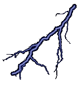
Replies to Comment # 1. Snow mixes with lightning, thunder
End Trace Mode for Comment # 1.
[Home] [Headlines] [Latest Articles] [Latest Comments] [Post] [Mail] [Sign-in] [Setup] [Help] [Register]